Mount Rainier National Park
Glaciated volcanic peak dominating Washington's alpine wilderness
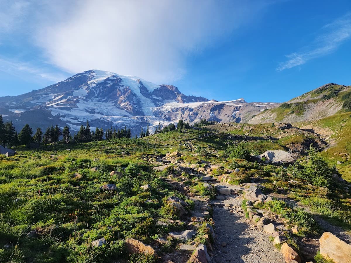
At 14,411 feet, Mount Rainier commands attention from Seattle's skyline 54 miles away. But get closer to this glaciated giant, and you'll find something better than Instagram views: 260 miles of trails threading through old-growth forests, wildflower meadows that explode with color each July, and 25 major glaciers carving the mountain's flanks. The park gets busy—really busy—during summer weekends. But venture beyond Paradise and Sunrise, and you'll discover why locals guard their favorite spots so fiercely. Here's how to experience Rainier without the crowds crushing your alpine zen.
Culture & Context
THE MOUNTAIN IS OUT
Mount Rainier is an active stratovolcano standing at 14,411 feet, and it dominates daily life across the entire Puget Sound region in ways that feel almost spiritual. Locals track its visibility the way others track the weather. When the peak appears above the cloud layer, people genuinely stop what they're doing.
The phrase "the mountain is out" carries real cultural weight here. It means cancel your plans and go outside. Outsiders sometimes underestimate how much the mountain shapes the local psyche.
Communities downstream in the Puyallup and Nisqually River valleys live under lahar evacuation routes. The warning sirens along those valleys were recently upgraded with voice instructions in English and Spanish. People here know what a lahar is.
The other cultural thread is mountaineering. Ashford, the last town before the Nisqually Entrance, is home to Whittaker Mountaineering, founded by the first American to summit Everest. That legacy runs deep.
Climbers show up here from every corner of the world. And the park itself welcomed roughly 2.4 million visitors in 2025, which means summer weekends feel like a city park more than a wilderness.
Go on a weekday if you can.
Local Customs
ARRIVE EARLY OR LATE
"The mountain is out" is the local phrase for a clear-sky day when Rainier is visible from Seattle and surrounding communities. Locals treat it as an event. If someone says it to you, the correct response is to go outside immediately..
Check the NPS webcam or a visibility forecast site before driving out. The mountain is famously cloudy and many people make the 2.5-hour drive from Seattle only to find zero visibility.
Locals don't make that mistake twice.. Buy Rainier cherries from roadside stands in Elbe and Ashford on your way in. They're grown locally and show up at little stands near the gas stations along SR 706 in summer.
Don't skip this.. Pack your own food and fill your gas tank before entering the park. No gas, no grocery stores, no ATMs inside.
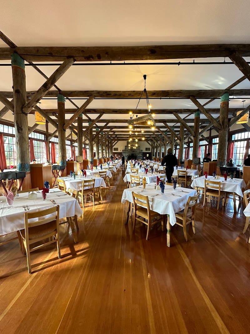
The cafeterias at Paradise and Sunrise are expensive and limited. Locals always have a cooler.. Arrive early or arrive late.
On summer weekends the parking lots at Paradise fill by 9am and Sunrise by 10am. After 4pm, people start heading out and spots open up. The long summer daylight (until 9pm) means a late-afternoon arrival is genuinely worth it..
Tire chains are legally required for all vehicles (including four-wheel-drive) between November 1 and May 1 when traveling on park roads. This is not optional and is enforced.. Dogs are not allowed on trails, in park buildings, on snow, or in park waters.
The park itself is largely off-limits for pets. Local boarding options near Ashford are limited, so plan ahead if you're bringing a dog.
Safety
LAHARS & LIGHTNING FAST
Real talk on the safety situation at Rainier in 2026. First: the volcano. A record earthquake swarm rattled the summit in July 2025, with more than 1,350 located earthquakes over several weeks.
Scientists kept the alert level at GREEN/NORMAL throughout. In August 2025, USGS conducted the first airborne volcanic gas survey at the summit since 1998, and detected no sulfur dioxide (the gas associated with rising magma). The consensus: the swarm was driven by hydrothermal fluid movement, not molten rock.
The mountain is not about to erupt. But it's worth knowing that Rainier carries real volcanic hazard, primarily from lahars (volcanic mudflows) that could reach the Puyallup River valley in under an hour. The lahar warning system was significantly upgraded in 2025-2026 with new sirens featuring voice instructions in English and Spanish.
If you're camping in a river valley below the mountain, know where the high ground is. Second: winter and technical climbing. Two climbers died on Wilson Glacier in January 2026 at approximately 9,600 feet.
Mount Rainier has recorded over 425 fatalities since 1897. Winter climbing requires serious experience. Summit temperatures rarely rise above freezing even in summer, and winter wind chills can hit -40°F.
Third: everyday trail hazards. Weather changes fast at elevation. Bring layers even on sunny summer days.
Bring the Ten Essentials on any hike, including short ones. Snow can linger on higher trails through July. The park strongly recommends downloading the NPS app offline before entering, as cell service is unreliable throughout.
And look: the Carbon River and Mowich Lake areas are completely inaccessible by car until at least 2031 due to the Fairfax Bridge collapse. Don't try to drive SR 165 expecting to reach them.
Getting Around
CAR REQUIRED, PLAN AHEAD
A car is non-negotiable. There is no public transit to Mount Rainier National Park. The drive from Seattle takes about 2.
5 hours depending on traffic and which entrance you're heading to. There are four entrances, and they're not interchangeable. Nisqually (southwest, SR 706) is open year-round and leads to Paradise and Longmire.
Stevens Canyon (southeast) connects to Ohanapecosh and Paradise, typically open late May through early October. White River/Sunrise (northeast, Highway 410) opens early July through mid-September depending on snowpack. The Carbon River entrance on the northwest side is effectively closed to vehicles.
The Fairfax Bridge on SR 165 collapsed structurally in April 2025 and won't be replaced until at least 2031, cutting off Mowich Lake and the Carbon River old-growth area entirely. On top of that, a 2.8-mile section of SR 123 between the Ohanapecosh area and Stevens Canyon is under construction April through October 2026, with delays up to 30 minutes.
The Fryingpan Creek Bridge on Sunrise Road is also being replaced (2026-2029), with 20-30 minute one-way traffic delays. Fill your gas tank before entering. The last reliable gas stations are in Ashford on the west side, Packwood on the southeast, and Greenwater on the northeast.
Cell service disappears shortly past Ashford and Greenwater. Download offline maps before you leave home. The good news: timed entry reservations were dropped entirely for 2026, so no booking a specific window through Recreation.
gov. It's first-come, first-served again. The tradeoff is that parking fills fast.
Paradise lots fill by 9am on summer weekends. Sunrise fills by 10am. The NPS recommends arriving before 7am or after 4pm on busy days.
Useful Phrases
Mount Rainier National Park Itineraries

Money-Saving Tips
- 1.Buy the America the Beautiful Annual Pass for $80 if you're visiting 3+ national parks this year—it pays for itself quickly
- 2.Bring your own food and drinks—the Paradise visitor center cafe charges $15 for basic sandwiches
- 3.Camp instead of staying at Paradise Inn to save $150+ per night, but book reservations early
- 4.Fill up your gas tank before entering the park—no gas stations inside and nearest stations charge premium prices
- 5.Pack layers from home rather than buying gear at REI in Seattle where a rain jacket costs $200+
- 6.Visit on weekdays to avoid weekend parking fees at some private lots near park entrances
Travel Tips
- •Arrive at Paradise before 8am on summer weekends or you'll spend an hour looking for parking
- •Download offline maps—cell service is spotty throughout the park and GPS can lead you wrong
- •Check road conditions the night before your visit—Stevens Canyon Road closes frequently for rockfall
- •Bring cash for entrance fees—card readers sometimes fail and backup systems are slow
- •Start hikes early to avoid afternoon thunderstorms that roll in around 2pm
- •Pack extra layers even on sunny days—temperature drops 3 degrees for every 1,000 feet of elevation
- •Keep food in hard-sided containers or bear canisters—marmots will chew through backpacks for snacks
- •Fill water bottles at visitor centers since natural water sources require purification
- •Wear bright colors during hunting season (September-November) if hiking outside park boundaries
Frequently Asked Questions
BUILD YOUR
MOUNT RAINIER NATIONAL PARK PLAN
Insider picks, smart timing, and a plan ready when you are.
Start Planning